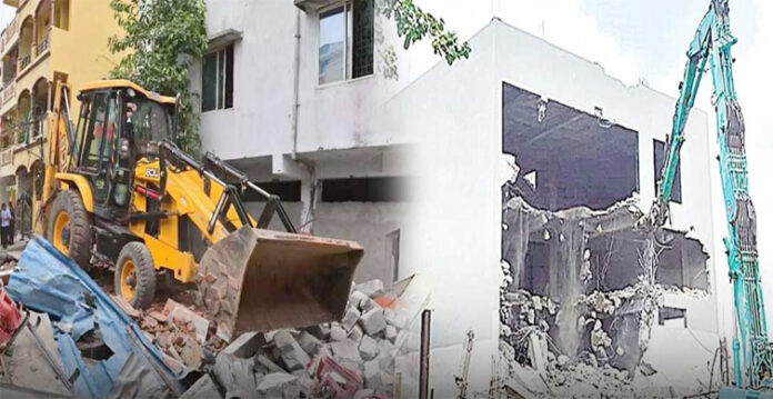
In a significant step towards safeguarding Hyderabad’s natural resources, the Hyderabad Disaster Response and Asset Protection Agency (HYDRAA) is set to introduce a new software application aimed at preventing illegal encroachments on lakes, parks, and government lands across the city. The app will enable authorities to quickly identify encroachments and allow citizens to report such illegal activities directly to the relevant departments.
The application is designed to ensure transparency and accountability in protecting public assets by tracking inspections and actions taken by officials. It is part of HYDRAA’s broader strategy to combat the ongoing issue of land encroachment, which has impacted the city’s water bodies and green spaces.
HYDRAA Commissioner and Lake Protection Committee Chairman, AV Ranganath, chaired a crucial meeting with representatives from several key departments, including the Irrigation Department, Revenue Department, National Remote Sensing Agency (NRSA), State Remote Sensing Application Centre, and the Survey of India. The meeting focused on strengthening efforts to protect Hyderabad’s lakes and green spaces from illegal encroachments.
Also Read: Kukatpally MLA Warns Against HYDRAA Harassment, Citing Bangladesh Example
Ranganath stressed the importance of removing debris from demolished illegal structures built on lake lands. He highlighted that the agency’s priority is to safeguard water bodies such as Sunnam Cheruvu, Appacheruvu, Errakunta, and Kukatpally Nallacheruvu in the first phase of this initiative.
One of the key components of HYDRA’s plan is to identify the Full Tank Level (FTL) and the maximum water spread area of the city’s ponds and lakes. The agency will use historical data collected over the past 45 years, cross-checked with recent data from the NRSA, State Remote Sensing Application Centre, and the Irrigation Department, to accurately map the boundaries of these water bodies.
Additionally, officials will review the 2018 Comptroller and Auditor General (CAG) report to ensure that the assessment of lake encroachments is thorough and accurate. This cross-verification process will help identify and address encroachments efficiently, ensuring that Hyderabad’s lakes and green spaces are protected for future generations.
Ranganath emphasized that the introduction of this new app, along with the collaborative efforts of multiple agencies, will significantly enhance Hyderabad’s ability to preserve its natural resources and take action against illegal encroachments swiftly.
This initiative marks an important move towards sustainable urban management, contributing to the protection of the environment and ensuring the city’s lakes and parks are safe from illegal occupation.
(This story is sourced from a third-party syndicated feed. Raavi Media takes no responsibility or liability of any nature. Raavi Media management/ythisnews.com can alter or delete the content without notice for any reason.)


